Back to the main page Back to category Compasses and GPS
watch details
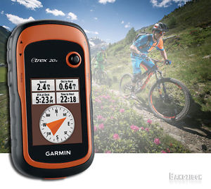
Garmin eTrex 20x GPS eTrex20 x Outdoor Unit Receiver Bike Mount Bundle Hiking
Estimated price for orientation: 219 $
Category: Compasses and GPS
Class:
Description Condition: New: A brand-new, unused, unopened, undamaged item in its original packaging (where packaging is applicable). Packaging should be the same as what is found in a retail store, unless the item is handmade or was packaged by the manufacturer in non-retail packaging, such as an unprinted box or plastic bag. See the seller's listing for full details. See all condition definitions- opens in a new window or tab ... Read moreabout the condition Brand: Garmin Type: GPS Model: eTrex 20x Features: 3.7 GB including preloaded maps, Digital, Waterproof MPN: 010-01508-00 Country//Region of Manufacture: China UPC: 753759141967
Preloaded Garmin TopoActive Map
eTrex 20x comes preloaded with the new Garmin TopoActive map of Western Europe, a perfect starting point for your first recreational activity with GPS. The map provides relevant useful information for activities like hiking and cycling, it's routable and shows elevation changes*. Garmin TopoActive Western Europe covers the following 23 countries: Andorra, Austria, Belgium, Denmark, Finland, France, Germany, Iceland, Ireland, Italy, Liechtenstein, Luxembourg, Malta, Monaco, Netherlands, Norway, Portugal, San Marino, Spain, Sweden, Switzerland, United Kingdom, Vatican City. Use the microSD™ card slot to load additional advanced maps – like Topo maps, BlueChart® g2 marine maps or City Navigator® NT maps. eTrex 20x also supports BirdsEye Satellite Imagery (subscription required) to download and integrate with your maps. Find Fun
eTrex 20x supports paperless geocaching GPX files for endless geocaching adventures. Just visit Geocaching.com to download geocaches straight to your device, then start hunting for caches! eTrex 20x stores all the key information, including location, terrain, difficulty, hints and descriptions. By going paperless, you're not only helping the environment but also avoiding the bother of manually entering co-ordinates. Plan Your Next Trip
Take control of your next adventure with BaseCamp™. The free, trip-planning software allows you to view and organise maps, routes and more, and even create Garmin Adventures to share with friends, family or fellow explorers. BaseCamp displays topographic map data in 2D or 3D on your computer screen, as well as a vast array of satellite images when paired with a BirdsEye Satellite Imagery subscription.
Description
| Condition: | New: A brand-new, unused, unopened, undamaged item in its original packaging (where packaging is applicable). Packaging should be the same as what is found in a retail store, unless the item is handmade or was packaged by the manufacturer in non-retail packaging, such as an unprinted box or plastic bag. See the seller's listing for full details. See all condition definitions- opens in a new window or tab ... Read moreabout the condition | Brand: | Garmin |
| Type: | GPS | Model: | eTrex 20x |
| Features: | 3.7 GB including preloaded maps, Digital, Waterproof | MPN: | 010-01508-00 |
| Country//Region of Manufacture: | China | UPC: | 753759141967 |
Preloaded Garmin TopoActive Map
eTrex 20x comes preloaded with the new Garmin TopoActive map of Western Europe, a perfect starting point for your first recreational activity with GPS. The map provides relevant useful information for activities like hiking and cycling, it's routable and shows elevation changes*. Garmin TopoActive Western Europe covers the following 23 countries: Andorra, Austria, Belgium, Denmark, Finland, France, Germany, Iceland, Ireland, Italy, Liechtenstein, Luxembourg, Malta, Monaco, Netherlands, Norway, Portugal, San Marino, Spain, Sweden, Switzerland, United Kingdom, Vatican City. Use the microSD™ card slot to load additional advanced maps – like Topo maps, BlueChart® g2 marine maps or City Navigator® NT maps. eTrex 20x also supports BirdsEye Satellite Imagery (subscription required) to download and integrate with your maps. Find Fun
eTrex 20x supports paperless geocaching GPX files for endless geocaching adventures. Just visit Geocaching.com to download geocaches straight to your device, then start hunting for caches! eTrex 20x stores all the key information, including location, terrain, difficulty, hints and descriptions. By going paperless, you're not only helping the environment but also avoiding the bother of manually entering co-ordinates. Plan Your Next Trip
Take control of your next adventure with BaseCamp™. The free, trip-planning software allows you to view and organise maps, routes and more, and even create Garmin Adventures to share with friends, family or fellow explorers. BaseCamp displays topographic map data in 2D or 3D on your computer screen, as well as a vast array of satellite images when paired with a BirdsEye Satellite Imagery subscription.
